Огляд Елементів
Ознайомтеся з нашою колекцією елементів
Accuracy of determining vertical deformations by the method of differential interferometry
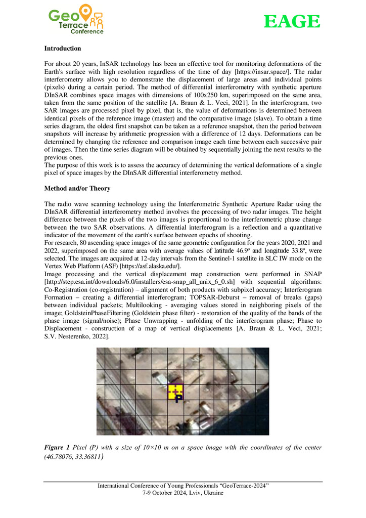
With the development of satellite SAR interferometry, it became possible to remotely obtain infor...

Comprehensive processing of InSAR radar images and GNSS measurements to determine deformations of the Kaniv HPP dam
Military aggression in Ukraine and military actions led to numerous technogenically loaded and ec...
Complex InSAR radar image processing, GNSS, and TPS measurements to determine the Kaniv HPP dam deformations Applied Geomatics
The article examines the combined use of satellite radar and stationary systems for monitoring sp...
Accuracy of determining vertical deformations by the method of differential interferometry
With the development of satellite SAR interferometry, it became possible to remotely obtain information about deformations of the Earth's surface. Differential Interferometry Synthetic Aperture Rad...
Стаття 2025/12/17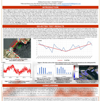
Comprehensive processing of InSAR radar images and GNSS measurements to determine deformations of the Kaniv HPP dam
Military aggression in Ukraine and military actions led to numerous technogenically loaded and ecological disasters in a third of the territory. Buildings and structures of various purposes were da...
Стаття 2025/12/17
Complex InSAR radar image processing, GNSS, and TPS measurements to determine the Kaniv HPP dam deformations Applied Geomatics
The article examines the combined use of satellite radar and stationary systems for monitoring spatial displacements of structures (SSMSDS) to detect vertical deformations of dams. The object of re...
Стаття 2025/12/12